Turkey-Syria earthquake: Satellite imagery shows scale of destruction
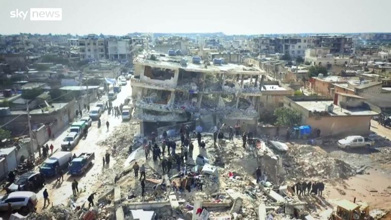
The images from towns near the earthquake's epicentre show entire streets flattened as well as makeshift camps set up to support rescue efforts.

Wednesday 8 February 2023 15:35, UK
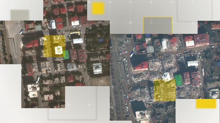
Satellite images from three devastated towns in southern Turkey show the scale of the devastation wrought by Monday's huge earthquakes in vivid detail.
Images taken by Maxar Technologies and Planet show scores of buildings reduced to rubble in Kahramanmaraş, Nurdağı and İslahiye and provide a glimpse of the efforts by humanitarian workers to save those still trapped.
Thousands are now confirmed to have been killed across Turkey and Syria after Monday's huge earthquake and the aftershocks that followed with many people still missing.
These pictures offer an insight into the enormous task facing emergency services in the coming days.
The epicentre of Monday's first and biggest earthquake, which measured 7.8 magnitude, was near the Turkish city of Kahramanmaraş.
Satellite images collected by Planet show entire streets of residential buildings reduced to rubble. Many have lost their roofs and roads can be seen filled with debris.
Read more:
Turkey-Syria earthquake - updates: President criticises 'provocateurs' as angry survivors complain of slow response
Urgent donations drive by UK charities to include national TV and radio appeals
Slide the arrow across the image below to see the difference between satellite imagery captured of the city in April 2021 compared with the day after the quake.
Just over 30 miles (48km) south in the city of Nurdağı, images captured by Maxar show a similar devastating scene.
A number of tower blocks that formerly stood at several stories high have been levelled, their distinctive red roofs broken into pieces.
White vehicles, possibly assisting with the rescue efforts, can be seen filling the surrounding streets.
Further evidence of what appear to be temporary rescue hubs can be seen in this image of one of Nurdağı's main streets.
White vehicles and trucks have filled the surrounding roads and what was formerly a park now houses over one hundred tents.
At least four tall buildings just next to the park have been razed to the ground.
Another makeshift camp can be seen in this image captured on the city's outskirts.
A large number of tents have been erected in four separate areas, with tens of vehicles parked next to them and many more travelling on the road next to it. A white lorry, which could be carrying aid supplies, is also parked at the site.
The town of İslahiye, which is just 14 miles (23km) south of Nurdağı, has also been badly affected.
In this image, only four of 15 tower blocks and one smaller building appear to still be standing in one complex following the earthquake.
A closer shot of a number of residential buildings shows the damage even more clearly.
Two buildings that were at least four stories tall have been reduced to rubble. Several other high-rise blocks have also sustained serious damage, with debris littering the area.
The Data and Forensics team is a multi-skilled unit dedicated to providing transparent journalism from Sky News. We gather, analyse and visualise data to tell data-driven stories. We combine traditional reporting skills with advanced analysis of satellite images, social media and other open source information. Through multimedia storytelling we aim to better explain the world while also showing how our journalism is done.